Summary of Main Ideas
Agricultural drones are revolutionizing farming by delivering precision insights that boost yields by 5%+ while slashing input costs. These unmanned aerial vehicles (UAVs) enable real-time crop monitoring, targeted spraying, and data-driven decisions that traditional methods simply can’t match. For business leaders, the value proposition is clear: reduced pesticide use, lower fuel costs, enhanced profitability, and competitive advantage through technology adoption. With sensors measuring everything from crop stress to soil moisture, drones transform guesswork into strategic planning. Case studies show 97% accuracy in crop analysis and measurable ROI through optimized resource allocation. This isn’t future tech—it’s happening now, and early adopters are reaping substantial economic and environmental benefits.
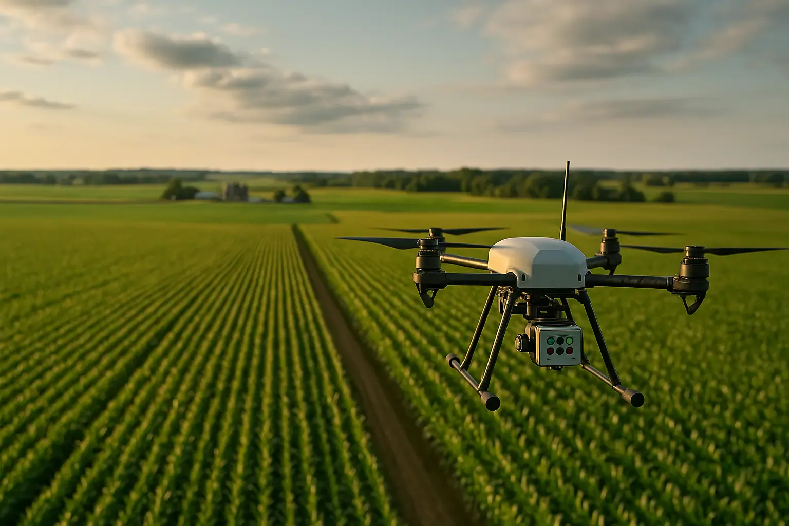
Think about the last time you walked through a 500-acre field trying to spot disease clusters. Exhausting, right? Now imagine sending a drone to do that same job in under an hour, with centimeter-level accuracy. That’s not science fiction—that’s precision agriculture in action today.
Agricultural drones have evolved from expensive novelties to essential business tools. They’re delivering measurable returns that make CFOs smile and operations managers breathe easier. But here’s what makes them truly game-changing: they turn your fields into data goldmines.

Why Smart Farmers Are Ditching Guesswork for Drones
Traditional farming often means treating entire fields uniformly. It’s like prescribing the same medicine to every patient, regardless of their symptoms. You spray pesticides everywhere, even where pests aren’t a problem. You irrigate uniformly, even though moisture varies wildly across your acreage.
Drones flip this model completely. They identify exactly which sections need intervention and which don’t. The result? You’re not wasting resources on healthy crops that don’t need them.
*Consider Nebraska farms that adopted drone technology for pest management.* Instead of blanketing entire fields with herbicides, they pinpointed infested zones. The savings on chemical costs alone justified their investment within two growing seasons.

The Three Powerhouse Categories of Agricultural UAVs
Not all drones are created equal. Understanding which type fits your operation is crucial for maximizing ROI.
-
Multispectral Imaging Drones are your field’s diagnostic specialists. Models like the DJI P4 Multispectral capture data beyond what human eyes can see. They measure the Normalized Difference Vegetation Index (NDVI), revealing crop stress before symptoms appear visually. Think of them as early warning systems that alert you to problems weeks before they’d otherwise be noticed.
These drones achieve centimeter-level accuracy, mapping crop health across hundreds of acres. For managers overseeing large operations, this means spotting nutrient deficiencies or water stress before they impact yields. -
Spraying and Seeding Drones handle the heavy lifting—literally. The DJI Agras T30 and T10 series autonomously apply pesticides, fertilizers, or seeds exactly where needed. Using radar navigation, they target specific zones with precision traditional equipment can’t achieve.
Here’s where the economics get interesting. These drones reduce chemical use, cut fuel consumption, and minimize labor hours. One operator can manage multiple drones, multiplying productivity without proportionally increasing payroll. -
Surveying Drones excel at creating comprehensive field maps. The DJI Inspire 2 and Phantom 4 Pro conduct high-resolution aerial mapping, soil analysis, and photogrammetry with 97% accuracy in crop counts. They generate 3D terrain models and orthomosaics that inform pre-planting strategies.
For enterprise operations, this mapping capability integrates seamlessly with existing GIS systems. You’re building digital twins of your fields that improve decision-making season after season.

The Sensor Technology That Makes It All Possible
Sensors are where drones transform from flying cameras into precision agriculture platforms. Let’s break down what each technology brings to your bottom line.
- Multispectral sensors measure light across multiple wavelengths, including invisible spectrums. This reveals crop health issues invisible to the naked eye. You’ll detect weeds, pests, diseases, and nutrient deficiencies before they spread. Early detection means smaller interventions and bigger savings.
- Thermal sensors assess irrigation effectiveness and soil moisture distribution. Are you overwatering some areas while others stay thirsty? Thermal imaging shows exactly where water is needed. For operations where water costs are climbing, this optimization directly impacts profitability.
- LiDAR and RGB sensors enable 3D terrain mapping without tedious image stitching. They support higher-altitude flights, expanding coverage per battery cycle. Direct georeferencing means faster surveying with higher accuracy than traditional methods.
- GNSS+INS positioning systems provide the precise coordinates needed for accurate orthomosaics and crop emergence tracking. This precision enables variable-rate applications where inputs match exactly what each field zone requires.
| Sensor Type | What It Does | Business Value |
|---|---|---|
| Multispectral | Detects crop stress via NDVI | Catch problems early, reduce losses |
| Thermal | Maps irrigation and moisture | Optimize water use, cut utility costs |
| LiDAR/RGB | Creates 3D field maps | Faster surveying, better planning |
| GNSS+INS | Pinpoints exact locations | Enables precision applications |

How Drones Stack Up Against Traditional Methods
Let’s talk frankly about the old way versus the new way. Traditional scouting means walking fields or driving through them, hoping to catch problems. You’ll inevitably miss spots. Manual observation is subjective, inconsistent, and time-consuming.
Whole-field treatments waste chemicals on healthy crops. You’re paying for pesticides that aren’t needed and potentially harming beneficial insects. Machine hours, fuel costs, and labor expenses add up quickly when you’re treating entire fields uniformly.
Drones operate differently. They scan every inch of your operation, identifying only the areas requiring intervention. This targeted approach reduces pesticide use substantially while cutting machine hours and fuel consumption. Data shows yields can increase up to 5% simply from better-informed decisions.
Speed matters too. Drones cover fields faster than traditional methods, completing in hours what might take days manually. For large operations, beyond-visual-line-of-sight (BVLOS) capabilities enable fleet deployments across vast acreages simultaneously.
Think of it this way: traditional farming is like advertising in newspapers hoping the right customers see your message. Drone-enabled precision agriculture is like targeted digital marketing—you reach exactly who you need to, when you need to, with the right message.
For more on how robotics and AI are transforming industries, see CES 2026 highlights on practical implementation for business transformation.

Real-World Applications That Drive ROI
Theory is great, but let’s get practical. How are businesses actually using drones to improve their operations?
-
Crop Monitoring and Yield Forecasting use machine learning algorithms to analyze drone imagery. You’ll generate accurate plant counts, emergence analysis, and damage assessments. Companies using this approach report 97% accuracy—better than human scouts could ever achieve consistently.
For managers planning harvest logistics, these forecasts inform equipment scheduling, labor allocation, and storage needs. You’re making decisions based on data, not hunches. - Precision Pesticide Application targets only infested zones. A Nebraska operation found that drone-identified pest clusters allowed them to spray 30% less area than traditional blanket applications. That’s direct savings on chemical costs plus reduced environmental impact—a win for both budgets and sustainability reporting.
- Targeted Seeding and Reseeding distributes seeds exactly where needed. Whether you’re planting new fields or reseeding damaged areas, drones handle large acreages efficiently. For operations managing thousands of acres, this capability scales beautifully.
- Soil and Field Analysis maps nutrient levels, identifies dead zones, and reveals drainage issues in real-time. Instead of random soil sampling, you get comprehensive field analysis that guides fertilizer applications. Apply nutrients only where they’re needed, in amounts your crops actually require.
- Pre-Season Planning leverages surveying drones to create 3D contour maps before planting. These maps inform decisions about seed varieties, planting patterns, and irrigation infrastructure. You’re optimizing from day one rather than reacting to problems mid-season.

The Economics: What CFOs Need to Know
Let’s talk numbers, because that’s what ultimately drives adoption decisions. Agricultural drones deliver multiple ROI pathways simultaneously.
- Input Cost Reduction is the most immediate benefit. You’ll use less seed, fertilizer, and pesticides because you’re applying them precisely. Fuel consumption drops when you’re treating smaller areas. Labor costs decrease because one operator manages more acreage than traditional methods allow.
- Yield Increases of 5% or more stem from optimized planting and treatments. Early problem detection means smaller crop losses. Better resource allocation means healthier plants and bigger harvests. In agriculture’s slim-margin environment, these percentage gains substantially impact profitability.
- Operational Efficiency multiplies as you integrate drone data into planning cycles. Year-over-year field intelligence improves strategies. You’ll know which zones consistently underperform and can adjust accordingly. Documentation created through drone monitoring supports insurance claims and regulatory compliance effortlessly.
Consider this scenario: A 1,000-acre operation spending $200 per acre on inputs reduces waste by 15% through precision applications. That’s $30,000 in savings annually. If yields increase 5% on crops worth $400 per acre, that’s another $20,000. A $50,000 annual improvement against drone investment costs typically measured in tens of thousands makes the business case compelling.
To see how strategic procurement and business planning impact technology adoption, read the Nvidia RTX 50 GPUs guide for business.

Environmental Benefits That Matter to Stakeholders
Sustainability isn’t just good PR—it’s increasingly important to investors, regulators, and consumers. Drones help you meet environmental goals while improving profitability.
- Targeted chemical applications minimize runoff into waterways. You’re reducing ecosystem impact while complying with increasingly strict pesticide regulations. Water optimization through thermal imaging prevents overuse, critical as water scarcity intensifies.
- Reduced fuel consumption from fewer machine hours lowers your carbon footprint. For enterprises with sustainability commitments, these measurable reductions support ESG reporting and corporate responsibility goals.
For reference on how changing environmental standards impact business operations, see the analysis of air quality on enterprise resilience.
Think of drone technology as enabling regenerative agriculture at scale. You’re using exactly what’s needed, where it’s needed, when it’s needed. That’s fundamentally different from the input-heavy approach traditional farming requires.

AI Integration: From Data to Decisions
Raw data is worthless without analysis. This is where artificial intelligence transforms drone imagery into actionable intelligence.
- Machine learning algorithms analyze multispectral images, identifying patterns human analysts would miss. AI recognizes early-stage disease symptoms from NDVI readings before visible signs appear. Automated systems flag problem areas, prioritize interventions, and even recommend specific treatments.
- Photogrammetry creates 2D and 3D orthomosaics without cloud dependencies. For operations in remote areas with limited internet connectivity, this offline capability is crucial. Your analysis happens on-site, enabling immediate decisions.
- Predictive analytics forecast yields, estimate optimal harvest timing, and project resource needs. You’re moving from reactive farming to proactive strategy. For managers overseeing multiple sites, AI-powered dashboards consolidate insights across your entire operation.
To better understand the role of GPUs and hardware advancements in AI for business, refer to the RTX 5090 vs RTX 4090 analysis for AI buyers.

Navigating Challenges and Regulatory Landscapes
No technology adoption is without hurdles. Understanding current limitations helps set realistic expectations.
- Battery Life constrains flight duration, though improving rapidly. Plan operations around multiple battery swaps or invest in multiple units for large acreages. Fleet deployments solve this limitation by using several drones simultaneously.
- BVLOS Regulations are evolving but currently restrict some applications. Beyond-visual-line-of-sight operations require special approvals in most jurisdictions. However, regulatory trends favor agricultural drone adoption as benefits become undeniable.
- Internet Connectivity in remote areas can limit cloud-based analysis. Choose systems offering offline processing capabilities. Many modern platforms operate independently, syncing data when connectivity returns.
- Pesticide Application Regulations increasingly favor precision approaches over blanket spraying. Drone technology aligns perfectly with regulatory direction, potentially future-proofing your operations against tightening restrictions.
For a deep dive into how regulatory and technology shifts shape large-scale procurement, explore the Boeing 777X folding wingtips business strategy.

What’s Coming: The Future Is Automated
Looking ahead, several trends will accelerate drone adoption across agricultural enterprises.
- Fleet Deployments will become standard for large operations. Instead of one drone covering 1,000 acres sequentially, ten drones will do it simultaneously. Autonomous coordination between units will optimize coverage and minimize operational time.
- Higher-Altitude Sensing with advanced sensors will expand coverage per flight. Improved battery technology will extend range and duration, reducing the number of units needed.
- AI-Driven Autonomy will minimize human oversight requirements. Drones will automatically identify issues, dispatch spraying units to affected zones, and update field maps without manual intervention. The entire sensing-analysis-action loop will operate autonomously.
- Integration with Precision Irrigation will connect drone moisture data directly to smart irrigation systems. Detect dry zones and automatically trigger targeted watering. This synergy between aerial intelligence and ground-based action represents agriculture’s fully automated future.

Proven Success: Companies Getting It Right
Real businesses are already realizing substantial benefits. Let’s examine what’s working.
- Equinox Drones deployed DJI models achieving 97% accuracy in crop and soil analysis. Their clients reported significant input cost reductions and improved profitability within two seasons. The precision enabled by multispectral imaging translated directly to bottom-line improvements.
- DJI Agras Series Users across diverse terrains demonstrate precision spraying’s versatility. From rice paddies to vineyard hillsides, these systems deliver targeted chemical applications. Users consistently report reduced product usage without compromising pest control effectiveness.
- Sentera with Septentrio combined multispectral sensors with GNSS+INS positioning for real-time crop health mapping. Their system optimizes yields cost-effectively, providing immediate insights operators can act on. The integration shows how combining technologies multiplies individual benefits.
- Large-Scale Nebraska Operations showcase pest management transformation. By pinpointing problem areas for targeted herbicide application, these farms cut chemical costs substantially. Environmental benefits include reduced runoff and improved soil health—demonstrating how profitability and sustainability align.

Making the Move: Strategic Considerations
If you’re evaluating drone adoption, consider these strategic questions:
- What’s your scale? Operations exceeding 500 acres typically see fastest ROI. Smaller farms benefit too but should carefully match capabilities to needs.
- Which problems cost you most? If pest management, irrigation, or crop health monitoring represent your biggest challenges, drones directly address these pain points.
- What’s your team’s technical capacity? Modern systems are increasingly user-friendly, but ensure your team can operate and maintain equipment. Training investments pay dividends.
- How will you integrate data? Drone technology generates massive amounts of information. Have systems in place to analyze and act on insights. The technology is only valuable if data drives decisions.
- What’s your regulatory environment? Understand local aviation and pesticide application rules. Partner with vendors familiar with agricultural operations in your jurisdiction.

The Competitive Advantage You Can’t Ignore
Here’s the reality: precision agriculture isn’t optional anymore—it’s becoming table stakes. Early adopters gain years of field intelligence competitors lack. You’re building institutional knowledge about your specific acreages that improves compoundingly.
In industries where margins matter enormously, even small percentage improvements in yields or cost reductions separate thriving operations from struggling ones. Drone technology delivers both simultaneously.
*For SMEs competing against larger operators,* drones level the playing field. You gain access to insights previously available only through expensive consultants or extensive staff. Technology democratizes precision agriculture.
For enterprises managing multiple sites, drones enable centralized oversight with local precision. You’ll spot patterns across your portfolio while addressing site-specific issues effectively.

Your Fields Are Waiting
Agricultural drones have moved from experimental to essential. The technology is proven, ROI is measurable, and adoption is accelerating. The question isn’t whether to adopt precision agriculture—it’s how quickly you can integrate it.
Your competitors are already flying drones over their fields. They’re making better decisions, reducing costs, and increasing yields. Every growing season you delay is a competitive advantage you’re conceding.
The future of agriculture is data-driven, precise, and sustainable. Drones are the eyes in the sky making that future possible today. For business leaders ready to embrace technology that delivers measurable results, the path forward is clear.
Start small if needed, but start now. Pilot programs prove value quickly in agriculture. Once you see the difference between guesswork and data-driven precision, you’ll wonder how you ever managed without it.

Key Takeaways
- Precision agriculture drones are now mainstream tools delivering measurable ROI and competitive edge.
- UAVs enable targeted resource application, real-time monitoring, and significant environmental benefits.
- The right combination of sensors (multispectral, thermal, LiDAR, GNSS) converts fields into data goldmines.
- Artificial intelligence is the bridge between raw imagery and actionable farming insights.
- Economic rationale: Benefits can exceed $50,000/year for large operations even at modest input cost savings and yield improvements.
- Environmental and regulatory trends strongly favor technology-driven, precision-first approaches.
- Don’t wait—the competitive advantage of early field intelligence compounds every growing season.
FAQ
-
Are drones really worth the investment for small and mid-size farms?
Yes—while the largest ROI is typically seen in operations exceeding 500 acres, even smaller farms benefit through better pest management, targeted irrigation, and reduced input waste. Many service providers offer drone data as a service so you don’t have to own the hardware upfront. -
What skills do I or my team need to operate agricultural drones?
Modern drone systems are designed for business users, not just pilots or tech experts. Basic training (often provided by vendors) is typically sufficient. Consider fleet management software and ensure someone on staff can manage batteries, sensors, and routine maintenance. -
How do regulatory issues affect my use of agricultural drones?
Most regions allow drone operation for agricultural purposes with baseline licensing. BVLOS (beyond-visual-line-of-sight) and pesticide application rules vary. Work with vendors who understand your jurisdiction’s requirements and look for evolving industry standards that support wider adoption. -
Can drone data be integrated with other farm management platforms?
Yes—most enterprise-grade solutions export directly into popular GIS, ERP, and farm management software. API availability is common, enabling seamless integration with existing digital workflows and equipment telematics. -
What’s the best way to start with agricultural drones?
Start with a pilot project focused on your largest pain point—pest monitoring, irrigation optimization, or variable-rate application. Choose a solution with end-to-end support. Use early data to quantify ROI before expanding to full-scale adoption. -
How quickly do most farms see ROI?
Many users report measurable savings and improved yields within one to two seasons, sometimes after a single harvest cycle.